Moving ‘the Dip’ in Carlsbad off the coast
Coastal adaptation is afoot in Carlsbad! With several feet of sea level rise on the horizon, the City has drawn up plans to move a section of Carlsbad Blvd away from the coastline - where it would otherwise block the beach from moving inland as seas rise and cost a lot of money to protect from flooding that will only get worse. Let’s take a closer look at the project, which, if done properly, will protect coastal infrastructure while saving the beach.
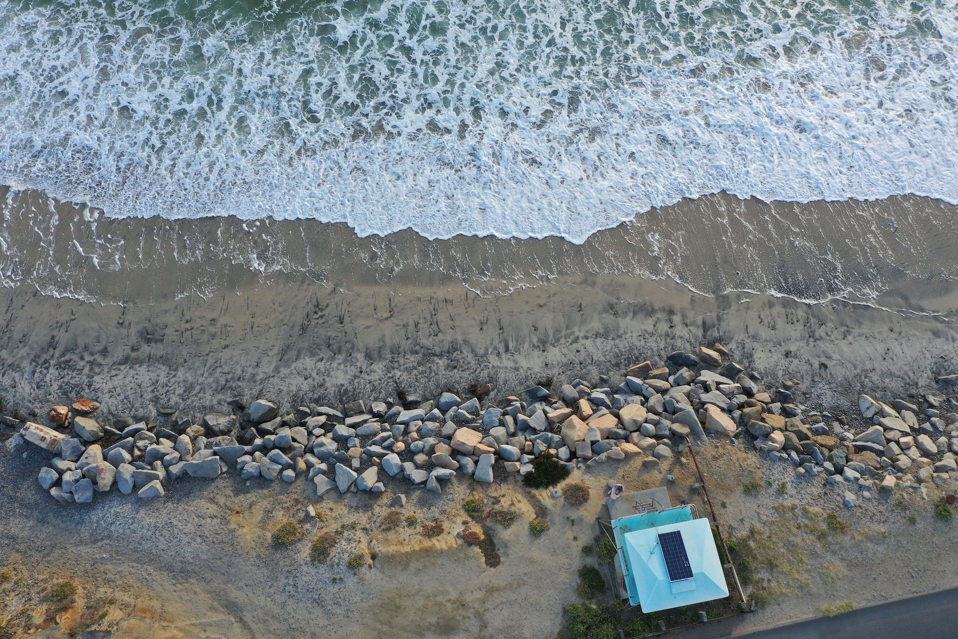
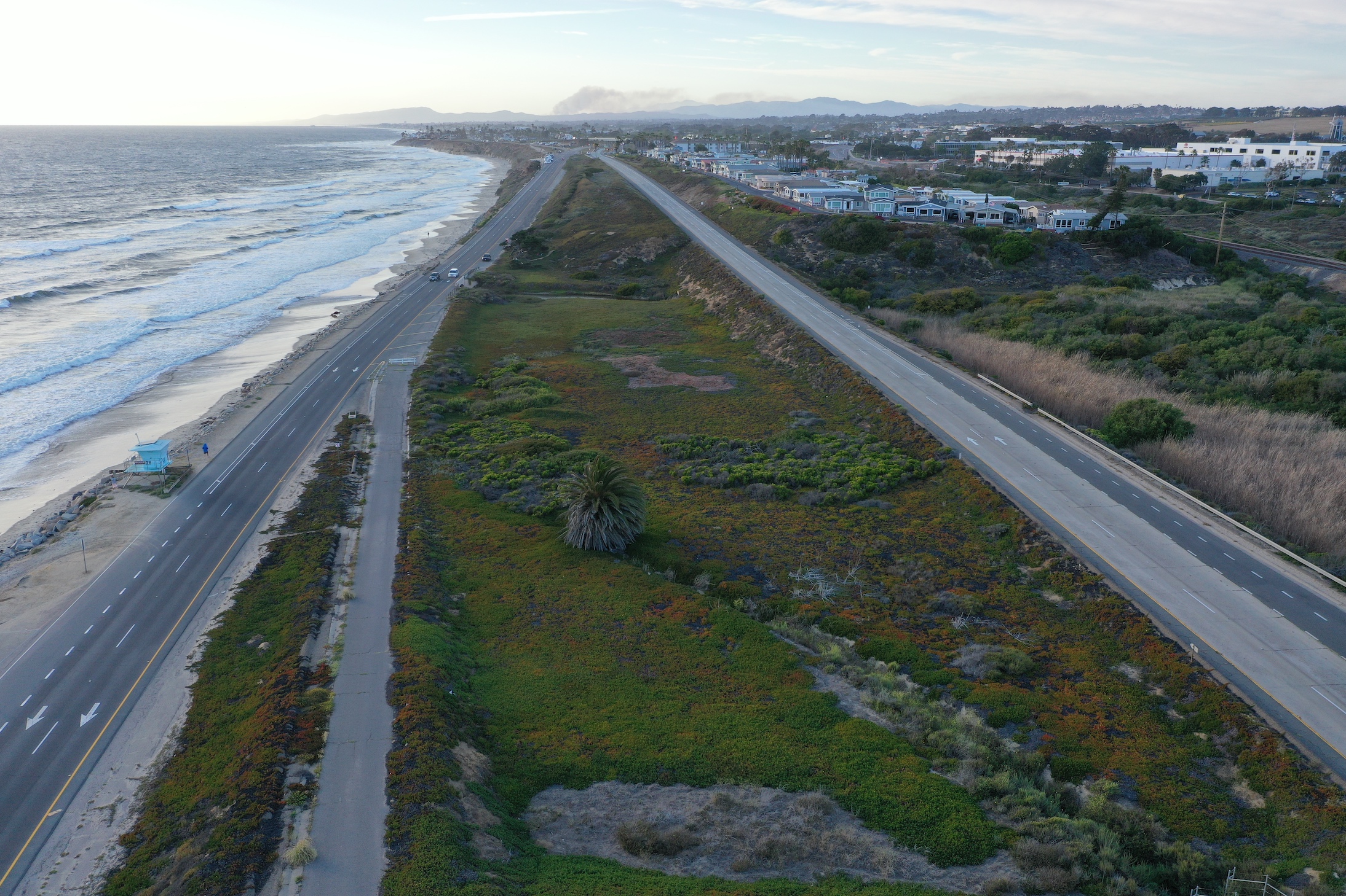
Southbound Carlsbad Blvd is already threatened along the “dip in the road” at Encinas Creek, where it descends towards sea level and fronts the beach before reascending to a higher elevation atop coastal bluffs on either side. To protect the road from being undermined by an encroaching ocean, the City has intermittently placed large piles of boulders (also known as riprap revetments) along the beach since 2009. The most recent revetments were added after heavy waves caused significant erosion during the 2015/16 El Niño winter. The damage resulted in a partial road closure and emergency permitting for additional rock protection, all of which remains there today.
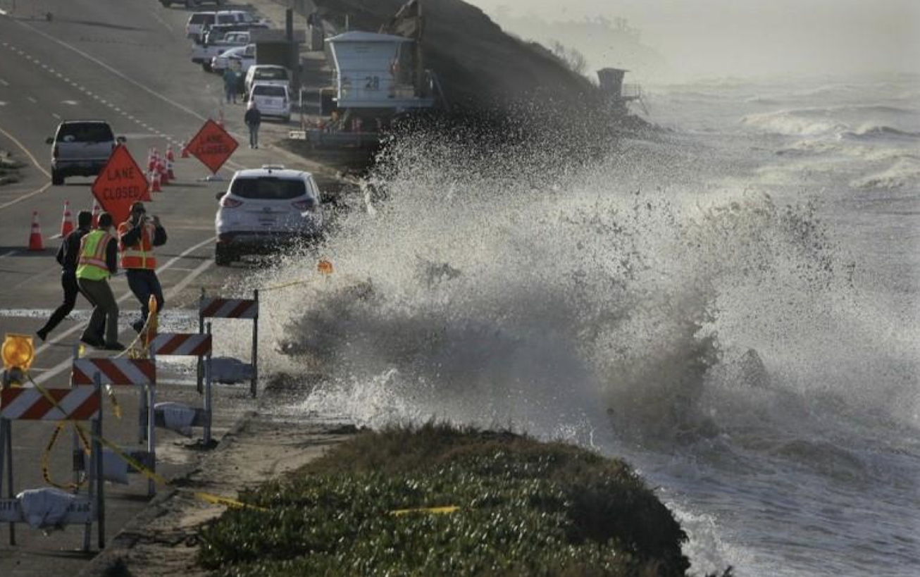
Partial road closure during 2015/2016 El Niño swell (City of Carlsbad)
We support relocation of the Dip because it leaves a beach
Since receiving state grant funds in 2020, the City has been gathering public input and fleshing out options to realign the road inland along a one-mile stretch that includes “the dip.” Surfrider believes that the Retreat Now option is the best because it’s the only one that preserves the beach in the long term.
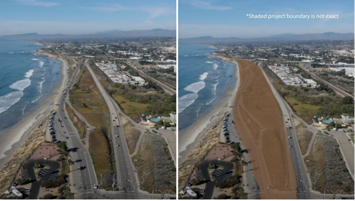
Retreat Now calls for demolishing the existing road once it’s realigned with Northbound Carlsbad Blvd, which sits several hundred feet inland. In its place, nature-based measures would be employed to manage erosion, such as an adaptable sand/cobble berm, which would allow the beach to slowly migrate landward with rising seas. GHD, the engineering firm hired to study several alternatives for the area, projected that the new pocket beach would be resilient even under an extreme sea level rise scenario of 6.6 feet!
In an area surrounded by bluff-backed beaches that are unlikely to fare well against a rising ocean in the next 50-75 years, proactive planning to protect and restore the beach here would provide tremendous value to the region. As GHD’s analysis states, the Retreat Now option “would have a stabilizing effect on the sand/cobble beach in the vicinity of Las Encinas Creek, providing multiple public and ecological benefits in a region that may have very limited beach area in the future.”1
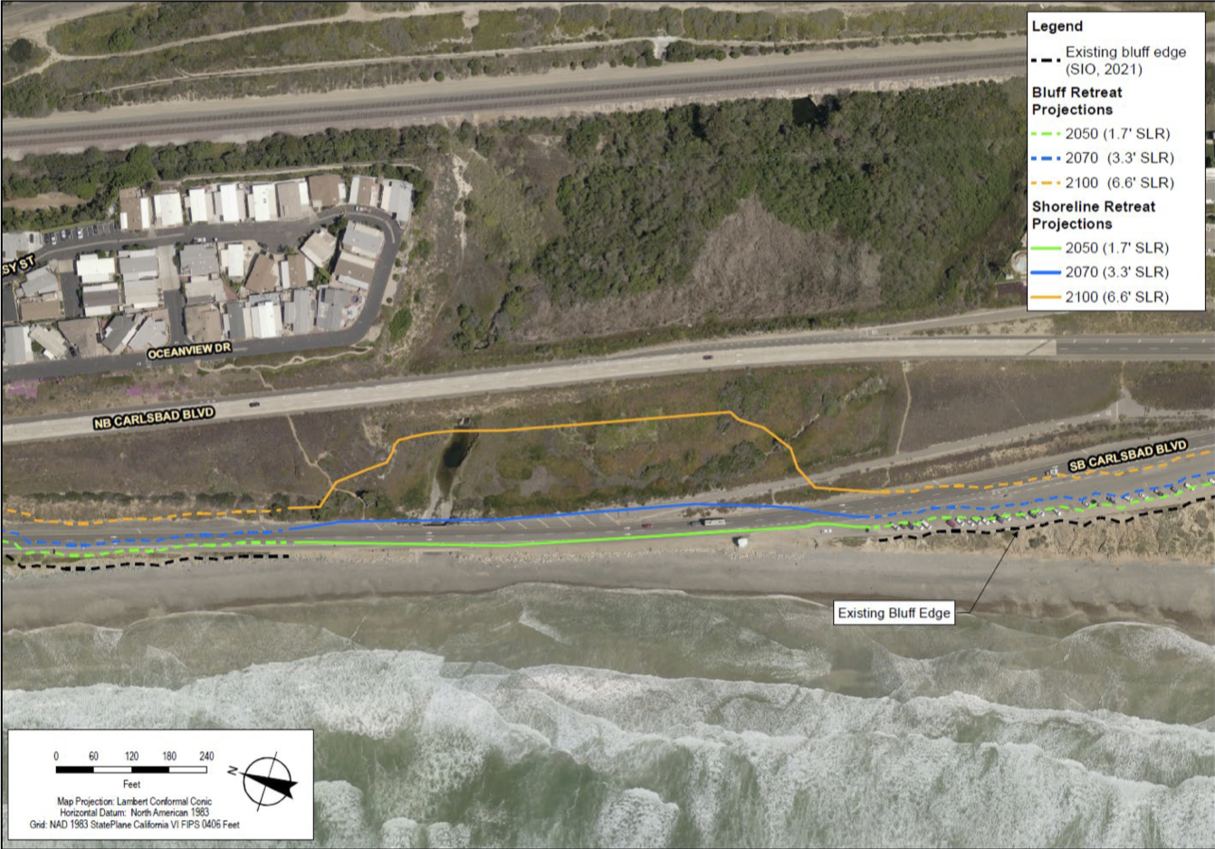
How the beach can adapt through 6.6' of sea level rise without the roadway (GHD)
Alternatively, GHD also presented the City with results for a Phased Adaptation (i.e. Retreat Later) plan. This plan also proposes to realign southbound Carlsbad Blvd inland to the northbound roadway’s location, but instead of demolishing the old coastal road as planned in Retreat Now, this option leaves the existing roadway and repurposes it as a bike/walk access path. GHD concluded that under this scenario, the beach would be lost entirely with 1.7 feet of sea level rise. With a foot of sea level rise certain by 2050 and potential for dramatic acceleration, Retreat Later puts a hard expiration date on a beach that will sorely be needed in the future.
The City is currently on the path towards Retreat Later. But there is still time to ensure we get the best possible changes to preserve the beach now and in the future.
Move the road, save the beach.
How Carlsbad came up with these options
After the El Niño swells of 2015/16, Carlsbad received an emergency permit from the California Coastal Commission to place riprap on the beach at “the dip”. The Commission later extended the permit for five years2 , but due to the known negative impacts of coastal armoring to beaches, required the City to develop a long-term management plan for the area upon the permit’s expiration. Additionally, Carlsbad’s own 2017 Sea Level Rise Vulnerability Assessment also categorized the roadway as a high risk exposure area and recommended realignment inland as a long-term solution.3
These developments led the City to apply for funding from the California Coastal Conservancy to plan the realignment project3, and they were awarded the funds in 2020. In truth, realigning Carlsbad Blvd. has been talked about since the 1980’s, but this is where the project’s modern history begins.
A City-produced rendering of the beach/park space to be gained via realignment
Move the road, but also leave it there?
In addition to presenting the Retreat Now and Retreat Later alternatives to restore the Las Encinas Creek area once the roadway is moved, GHD helped conceptualize potential new road designs. City staff unveiled three options, aka alternatives, during summer of 2022. All three move southbound Carlsbad Blvd inland and connect it to the existing northbound road; however, the projects vary in how the relocated road manages traffic. Unable to reach consensus, the City Council agreed5 that staff should conduct a traffic study and report back with their findings to help inform their decision. This stalled the decision for the past year.
We understand that lane reductions and roundabouts tend to be controversial. But the real controversy is that despite the clear benefits of Retreat Now, all three of the current realignment alternatives leave the old roadway as a bike/walk path instead of demolishing it. Surfrider would typically not be opposed to such a public access pathway, and we should note that Retreat Now also includes an optional unpaved access trail, which would be much more adaptable. Meanwhile, we know well what the Retreat Later study confirms: leaving the existing roadway in place will ultimately kill the beach as sea levels rise. The riprap revetments - which currently occupy and ultimately erode valuable public beach space - would need to remain as well, thus negating the entire spirit of the long term management plan required as part of the City’s 5 year permit (originally an emergency permit).
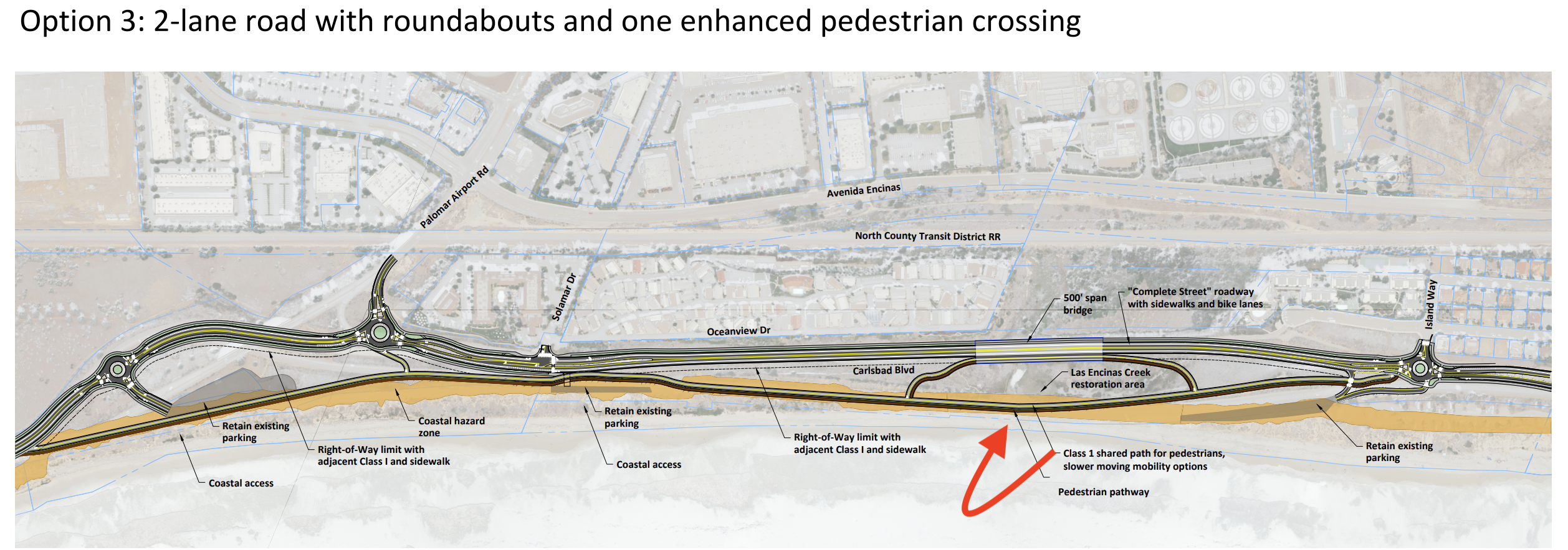
All 3 options leave the old roadway in place for the time being (see them HERE)
*on June 20, 2023, the City Council selected Option 2 is the preferred roadway design
Eyes on the prize, Carlsbad
Rising tides bring dramatic threats to our coastline. The South Carlsbad Blvd project is a shining example that wherever feasible, a planned retreat from the coastline offers multiple benefits for both public beaches and threatened infrastructure. The City of Carlsbad has an opportunity to move a threatened roadway out of harm’s way before it’s too late, while at the same time creating a climate-resilient public beach in place of one that is rapidly eroding. It’s a win-win scenario for everyone, but only if the project stays on course.
As the decision making process moves along, we must consistently remind city leaders to keep their eyes on the prize: the Retreat Now vision. Now that the traffic study is complete, staff will be presenting it to several council-appointed commissions for input before going to City Council for a final decision this summer.
1Las Encinas Creek Habitat Restoration Alternatives Analysis, GHD. January 2023
2 Application No.: 6-16-0450. March 14, 2018. California Coastal Commission
3Consider landward migration of public assets, p.38. City of Carlsbad Sea Level Rise Vulnerability Report, December 2017
4In addition to realignment planning and habitat/beach restoration along the one-mile stretch from Manzano Dr. to Island Way, the grant funds were also used to study coastal erosion along a larger, 3-mile stretch from Terramar to La Costa Dr.
5For the record, the council-appointed Traffic and Mobility Commission originally requested the traffic study, not the City Council. Council did agree to move forward with the study.
 Mitch served in various volunteer leadership positions with the San Diego Chapter before being hired on as Chapter Manager in 2018. In 2022, he transitioned to the chapter’s policy role. In 2025, he's broadened his scope as California's Senior Policy Coordinator.