The highest highs and lowest lows of the year
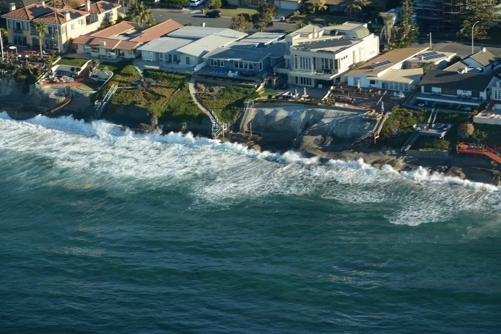
Each year, the annual King Tides provide a dramatic experience along our beaches. From December 4-6 and again on January 2-3, we'll witness the highest and lowest tides of the year. Each morning, an almost 7 foot high tide will drown many of San Diego's beaches. It's the best preview we have of what a normal high tide will look like after 1-2 feet of sea level rise, which is expected in the next 30-50 years.
Our Beach Preservation Committee documents the king tides each year at various San Diego County beaches in order to create a visual aid for coastal policymakers and the general public. We achieve this by enlisting volunteers to help us document both the high and low tides. Check out our compilation videos from previous King Tides in 2022 and 2024:
Read on to learn how YOU can help us document the phenomenon!
When are they?
For the upcoming December and January dates, we would like to crowdsource both high and low tide video and photos of as many San Diego County beaches as possible. GoPro time lapses and drone videos are welcome, but most smartphones can capture compelling footage of the high tide, the low tide, or both.
Below are NOAA's predicted high and low tides for December 4-6. Please note these predictions are for La Jolla; exact timing and height of the tide extremes may differ slightly as you move up and down the coast.


Tide swings are gradual. If you're unable to observe and/or capture footage at the exact high or low tide time, that's OK. We suggest arrival within 30 min-1 hour of the stated high and low tide times at the beach site you choose to visit.
How to document the king tides
Ideally, you can capture both landscape and portrait video footage, plus a few photos. Here are some helpful guidelines to make the most of your documentation.
- We are looking for video footage of the same spot at both high and low tide.
- If you're using a phone, prioritize holding your screen in the horizontal/sideways position to optimize a wide angle that is better for Youtube-style videos. That said, we also appreciate portrait-sized videos (for social media), along with photos.
- We typically use video snippets between 3-15 seconds long.
- For the HIGH TIDE, we're looking for:
- Beach loss in areas where beaches usually exist during normal tide conditions.
- Flooding of coastal infrastructure, i.e. the ocean breaching onto roads, walking paths, parking lots, lifeguard towers under water, etc.
- Waves overtopping any infrastructure (private property, roads, access paths, etc.).
- Footage needs some land-based reference to be compelling - parking lot, riprap revetment or seawall, lifeguard tower, beach access staircase, etc. It's difficult to gauge the king tide effect if footage only shows waves washing ashore on a sandy beach without references.
- Please be mindful of your safety and keep a safe distance from the observed high tide line (especially if there is a good swell that day). Safety first!
- Please return to your same spot in the afternoon to capture low tide images. Again, capturing footage with easy-to-identify leverage points is best for the viewer.
- If you operate a drone or have high quality videography equipment and would like to contribute at a priority beach site, please email beachpres@sandiego.surfrider.org to coordinate.
- Volunteers are welcome to document at the beach of their choice. However in hopes of compiling footage that is both compelling and useful for our beach preservation efforts, we've created a public Google Sheet (access gained once you register with button below) with some suggested beaches to document. Please sign up to any location that you'd like to observe and document. For any questions or if spreadsheets aren't your thing, please email beachpres@sandiego.surfrider.org.
- Beaches aren't the only thing worth observing and documenting - any body of water affected by tidal swings can be compelling. Examples include Mission Bay, San Diego Bay, and coastal wetlands (the Bayshore Bikeway in Imperial Beach, for example, often floods during the king high tides).
Why are we doing this?
King Tides often produce flooding in low-lying areas near the coast. But the real danger comes when large surf coincides with these extra high tides, which is expected to occur more and more frequently due to climate change and rising seas. The past two seasons of high tide storm surge caused countless partial bluff collapses, knocked a pillar off the now permanently-closed Ocean Beach Pier, destroyed the Cardiff Reef parking lot, closed the Beacon's beach access trail for several months, and more. Will the trend continue this winter? There's only one way to find out!
Dramatic flooding aside, our hope is that if beachgoers see how rising seas will affect the beaches they love, they'll support proactive efforts to plan for it. We must urge our leaders to take sea level rise seriously, so that we can save as many beaches as possible.